Difficulty level
Moderate, a bit steeper ascent around the Cave in Čuba
Length and elevation
7.3 km; 275 vertical meters
Required outfit
Hiking shoes, suitable clothes, walking poles (recommended), a headlamp, food, a drink
Duration
3 hours at a hiking pace
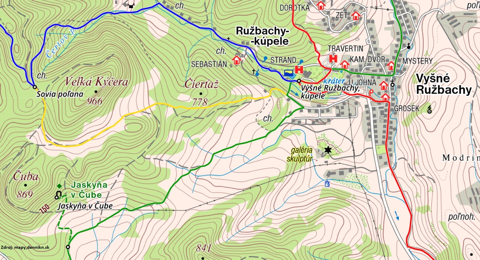
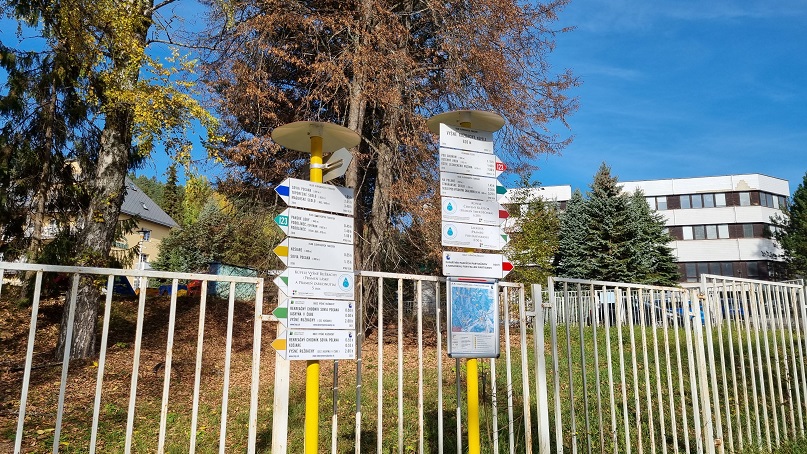
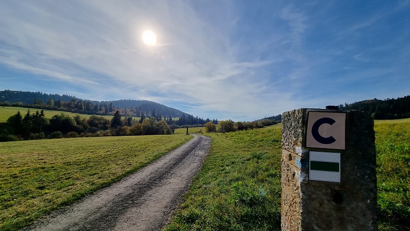
The Oxygen Route – Forest begins near the entrance to the summer-time outdoor swimming pool, by the hiking signpost. Walk a few meters further through the spa gate, on a steel bridge over a stream, on a path leading to the Love and Oblivion Springs. This trail is identical to the yellow- and blue-marked trails. The blue trail turns right once you cross the bridge. You, however, continue a few meters along the green trail up a steep slope, a few meters further up to an asphalt road. At this spot, the yellow trail detaches and turns right. From there, you turn left, pass a wooden cabin and continue towards family houses; at the first intersection, follow the green marker directed to the right.
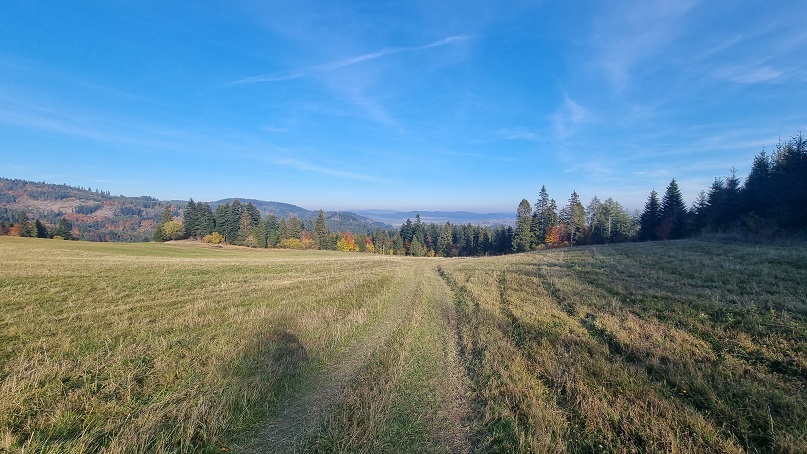
The green marker will lead you across the area with family houses and cottages, but soon you will arrive to beautiful large meadows. The asphalt path, which has a solid surface all the way up to the top of the first ascent to Lustová Saddle, is elegantly crooked along a quiet stream with thick bushes, providing wonderful views of the surrounding green mountains and extensive meadows. It is not rare to see some roe deers, red deers or foxes running around. Look up from time to time as you may notice a beautiful bird of prey.
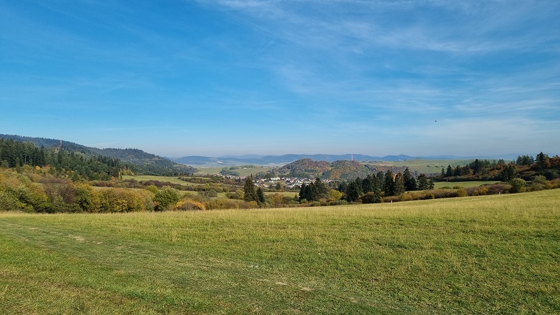
Higher parts of the meadow offer beautiful views of a picturesque village of Vyšné Ružbachy. The entire first ascent to Lustová Saddle is very pleasant, without any steep sections, and its surface is well treated. This trail is also suitable as an individual walk. If you feel tired enough, we do not recommend hiking on as the route ahead includes a descent and one more ascent, this time more difficult one.
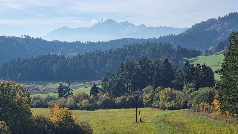
Your journey continues from Lustová Saddle down to the village of Podolínec. The solid path now ends and you continue across a meadow. In sunny weather, the beautiful High Tatras stand out right in front you. Take a while and enjoy the panorama with the outstanding Slavkovský Peak on the far left, further to the right the extensive Lomnické Saddle, the highest Lomnický Peak, then Kežmarské Peaks, Ľadový Peak in the background, as well as Kolový and Jahňací Peaks. In front of the panorama of the High Tatras, you can see a ridge of the Belianske Tatras which affords a picturesque panoramic view.
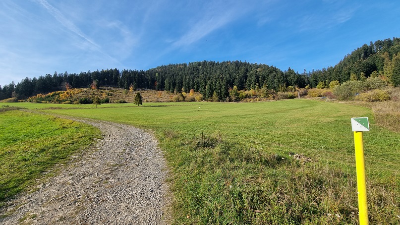
Continue across green meadows down to the fields and follow the path on a plane until you see a signpost with an arrow showing the path to a cave. Turn right and follow the oblique green mark up the hill. This ascent is mild at the beginning, leading across meadows on a gravel path, and then steeper through the forest. As you enter the forest, after a few meters of a bit steep ascent the marker will lead you to the left. After a short while, you will arrive to a spot under the Cave in Čuba.
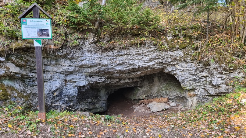
The Cave in Čuba is open to public and according to official sources, it is 18 meters deep. You may look inside, but after a few steps the space becomes too narrow and it is impossible to continue. It is a natural monument, so it is important to bear in mind not to cause any damage. The cave was formed by underground water and it is located at the foot of the Čuba Hill at the altitude of 750 meters above the sea level, as you may read on the notice board installed in front of the entrance to the cave.
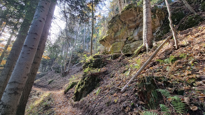
Your trail then ascends around the cave, following the oblique green marker. After several tens of meters, the marked trail turns right from a wide road to a narrow path up the hill in serpentines. It will lead you through a stone city and under beautiful rocks, as you may see in the photos. Although the whole journey up is rather difficult and steep, still just half the way to the end, there is no difficult ascent ahead, only a few small ones, so this one is the last difficult ascending section.
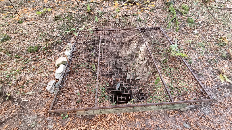
This route leading up around the Cave in Čuba ends near an interesting cave covered by a grid. After you pass this deep abyss, the path descends toward a signpost that will direct you to the right towards Sovia Poľana meadow. A pleasant flat trail traverses the whole Čuba Hill, and soon it will lead you above the meadows where you will find the Košiare signpost.
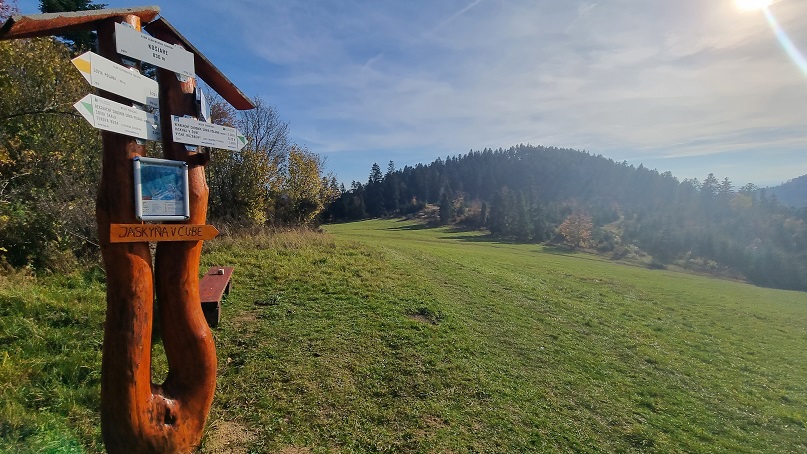
Košiare is a beautiful spot with a wooden signpost with and a comfortable bench facing west, where it is usually very pleasant and warm to sit in the afternoon. From the path around Čuba, you still need to walk down a few meters and then up again. Views of the High Tatras and Belianske Tatras will be more and more beautiful as you walk across the meadow towards Vyšné Ružbachy. You will still have to walk a few meters up the meadow, and from the top of it you may enjoy some beautiful views.
Heading away from Košiare, follow the yellow-marked trail which leads to Vyšné Ružbachy. From the top of the meadows, you will descend only. The trail across the meadows will lead you to the edge of the forest where the yellow marker will lead you along a well visible forest path. You will come to a meadow again above the water reservoir station. Walk around it and you will get to the same point to which you ascended from the spa on a steep path at the beginning of your journey. Now, go down this path and the bridge above the stream will lead you back the spa resort.